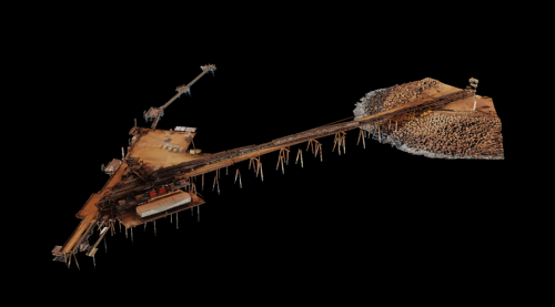
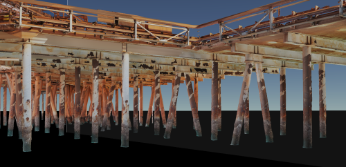
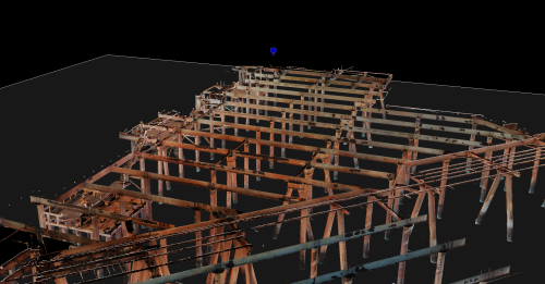
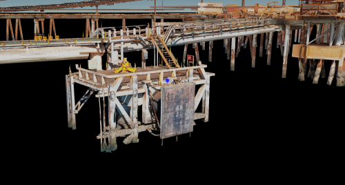
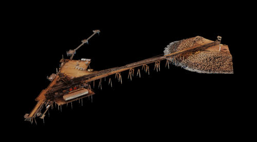
3D Model of Jetty (Top and Underside) for General Visual Inspection (GVI) Using Drones and various camera sensors to create a Photogrammetry Mesh Model is currently in progress for a major mining operator. The project is in its initial stages, with the first stage of data capture and processing completed for the tail-end jetty. This data is hosted on our proprietary web platform, inSite.
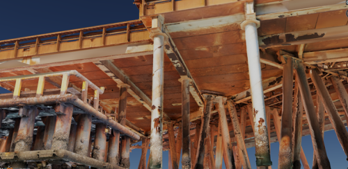
3D Jetty Inspection using aerial and ground-based Photogrammetry
The project is currently in the work-in-progress phase, with planning underway for the second data capture stage during an upcoming shutdown. Upon completing the second stage of data capture and subsequent data processing, the two models will be merged and delivered to the client through our InSite platform. The project is expected to be completed within 4-6 weeks after the initial data capture, meeting the specified timeline.
Introduction
Vertech Australia, NZ, and USA deliver a comprehensive array of inspection, Non-Destructive Testing (NDT) and maintenance packages, all underpinned by innovative specialist access systems.
AUAV is a cutting-edge company at the forefront of the rapidly evolving field of uncrewed aerial vehicles (UAVs) and 3D modelling. With a wealth of experience and expertise, we have established ourselves as pioneers in the industry, consistently delivering innovative solutions to our clients.
Our primary focus is on harnessing the power of drones and various camera sensors to provide exceptional services in 3D modelling. We specialise in creating highly detailed and accurate 3D models of diverse structures, landscapes, and objects.
At AUAV, we pride ourselves on our commitment to innovation and excellence. Our team of experts combines cutting-edge technology with a deep understanding of UAVs and photogrammetry techniques to provide tailored solutions that meet the unique needs of our clients. Our extensive experience in the field has allowed us to work with a diverse range of industries, including mining, construction, and environmental monitoring.
Innovation
AUAV stands at the forefront of innovation in our geography by pioneering advanced techniques in drone-based 3D modelling. Our unique approach combines cutting-edge UAV technology with state-of-the-art camera sensors to provide unprecedented detail and accuracy. This innovative blend of technology and expertise allows us to offer unmatched services in capturing and visualising complex environments and structures.
Project Summary
AUAV, headquartered in Melbourne, Australia, is redefining the landscape of drone-based 3D modelling with our innovative and forward-thinking approach. With a relentless commitment to excellence, we have pioneered groundbreaking techniques that have transformed how industries in our region harness the potential of aerial and ground data capture and analysis.
Our primary mission is to deliver comprehensive 3D modelling services with unparalleled precision and detail. These services have broad applications across diverse industries, including mining, construction, environmental monitoring, and infrastructure inspection. We have elevated the standards for 3D modelling processes by leveraging cutting-edge UAV technology and state-of-the-art camera sensors.
Our innovation’s core is the fusion of high-tech tools and deep expertise. We employ the latest UAV technology to capture data efficiently and accurately. Our state-of-the-art camera sensors allow us to capture intricate details and produce 3D models that are not only highly accurate but also visually striking.
A pivotal component of our innovative approach is our in-house developed web portal, inSite™. This platform is the central hub for hosting, managing, and visualising the 3D models we generate. Clients can access and explore these models effortlessly through an intuitive user interface, streamlining collaboration and facilitating informed decision-making. inSite empowers our clients by providing a centralised repository for all project-related data, simplifying data management and enhancing project efficiency.
Our commitment to staying on the cutting edge extends to our strategic partnerships with leading technology providers and research institutions. These collaborations ensure that we continually leverage the most advanced tools and methodologies available in the industry. By working closely with industry leaders and academic institutions, we remain at the forefront of technological advancements, constantly pushing the boundaries of what is achievable in drone-based 3D modelling.
Conclusion
AUAV’s pioneering efforts in drone-based 3D modelling have not only transformed how our clients approach data capture and analysis but have also led to significant improvements and cost savings across various industries in our region. Our commitment to innovation has empowered businesses to make more informed decisions based on highly accurate and visually immersive 3D models.

